






描述
ULTIMATE ROAD TOOL
Your city starts with its roads. Build connected streets directly in Unreal Engine, from a single curve to a large, editable network. Shape roads, junctions, sidewalks, lane markings and surface wear in one focused editor workflow.
NEW IN 1.2 — EXPLORE A GEOGRAPHIC CITY
The separate example download adds an experimental Cape Town network with more than 5,800 editable roads, generated from municipal geographic data. Every road uses the same spline authoring tools as roads you draw yourself. This is the beginning of a broader city-building workflow.
The release also improves junction rebuild reuse, edit restoration, road tiling and paint projection. The original 1,200-road city stress example and smaller showcases remain included.
STAY IN THE FLOW
Click to extend, then keep clicking to continue. Insert nodes, snap to roads, create connections and undo placements. Switch between the full Road Editor panel and a compact viewport toolbar.
LANES, MARKINGS & TURN POCKETS
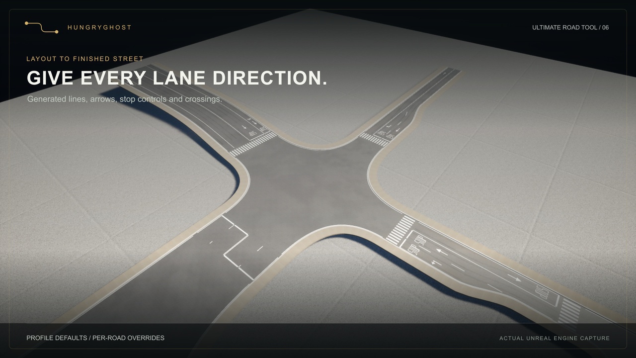
Choose lane counts in each direction, including one-way streets. Generate road lines, arrows, STOP lettering, stop/yield controls and zebra crossings. Start with profile defaults, then customize individual roads, lane types, paint materials and approaches.
Add left and right turn pockets with adjustable width, storage and taper. Asphalt, curbs, sidewalks and paint follow the widening. Two-road connectors continue matching lane markings through curves and width transitions.
FIVE ROAD STYLES. YOUR OWN CITY.
Urban, Residential, Industrial, Boulevard and Heritage profiles include original modular geometry, independent sidewalks, adjustable widths and scanned surfaces. Tune grime, edge dirt and tire wear. Road-aligned mapping follows curves; generated junction slabs include an underside for elevated views.
BUILT AROUND LOCAL EDITS
Spatial lookups find nearby roads, queued rebuilds update affected geometry, and wear changes without rebuilding the network. Large-network performance depends on hardware and layout. The geographic example loads the whole map and can take several minutes with substantial memory use; start with a smaller showcase. It is not a streaming or baked-LOD solution.
INCLUDED
C++ source plugin with Runtime and Editor modules
Five modular styles, original Blender/FBX sources and CC0 surface scans
Basic, surfaced, markings and 1,200-road editable city maps
Separate example project with the experimental geographic city
Road Editor, lane layouts, generated markings, surface wear and documentation
EXPERIMENTAL GIS EXAMPLE
The Cape Town example is a flat-ground interpretation of 2D data. Elevations, traffic rules, lane counts and sidewalks are provisional. Complex junctions, close carriageways and some circle connections still need manual adjustment. It is an editable road-network example, not a finished city environment or surveyed road reconstruction.
A general GIS import interface, automatic GeoScape terrain fitting and traffic simulation are not included. GeoScape is a separate product. Municipal centerline attribution and source terms are included in the example.
REQUIREMENTS & SCOPE
Unreal Engine 5.8, Windows editor and Win64 games. Geometry Scripting and ZoneGraph are required. UE-compatible Windows C++ tools are needed for source builds and game packaging. No external account or subscription is needed to use the supplied content.
Painted controls do not implement Mass crowds, vehicle routing, signals or pedestrian queues. Bridge structures, separate curved slip roads, physical signs and arbitrary decal painting are not included. Connections require sufficient angle, grade and junction space. Short approaches can suppress pockets or symbols that cannot fit. Road markings are customizable visual conventions, not certified national-standard layouts.
Discord: https://discord.gg/UsjBj73spu