Açıklama
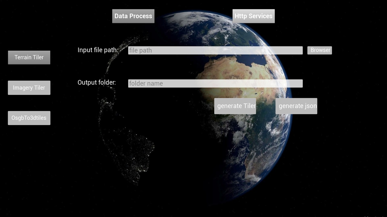
Process elevation tif data, image tif data, and tipping model osgb data, and publish them as services, which can be used locally by the Cesium for Unreal plugin. Without using cesium Ion services.
Changelog
*(03/01/2023) Version 1.1: Solve the problem of command window flashing and tiling failure when terrain and image tiling.
*(03/17/2023) Version 1.2: 1. Resolved the issue that imagery cannot be displayed on UE5.1. 2.Optimized UI display and operation