
Açıklama
Dubai Real-Scale 3D City Map | 2025 Gis-Based Data - Gökhan Emre Er
“Designed for content creators who need not only visual appeal, but also accuracy, scalability, and performance.”
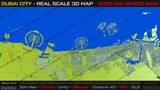
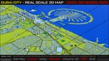
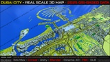
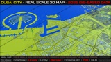
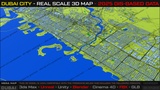
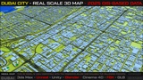
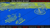
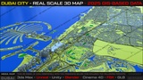
Accurate Scale • Clean GIS Topology • Full Coastline Coverage and Downtown - Full City Details
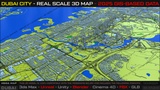
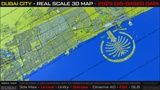
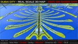
This high-quality 3D city map represents Dubai at full metropolitan scale, covering approximately 120 + 60+ kilometers of coastline with accurate proportions and clean GIS-based topology.
The map includes Dubai’s most iconic districts and landmarks, such as Palm Jumeirah (Jumeirah & Jebel Ali), Dubai Marina, Downtown Dubai, Dubai Creek, Deira, and surrounding urban zones. Designed for clarity, performance, and realism, it balances visual fidelity with optimized geometry.
Cinematic fly-throughs & matte shots
Open-world and city-builder game prototyping
Urban & traffic simulations
Architectural and concept visualization
Large-scale environment blocking
Broadcast, Movie, Game Industry or Documentary Products; Premimum Dubai 3D Map Set.
Key Features
Real-world scale urban proportions
Full Area Dubai + Surrounding districts
GIS-based city layout (2025 derived data)
Clean, optimized block geometry
Clear road hierarchy & readable city structure
Engine-friendly topology
Modular and extensible design
Important Notes:
All Software platforms easy import.
Buildings are intentionally block-based for performance and scalability
Designed to be customized, detailed, or expanded by the user