
Açıklama
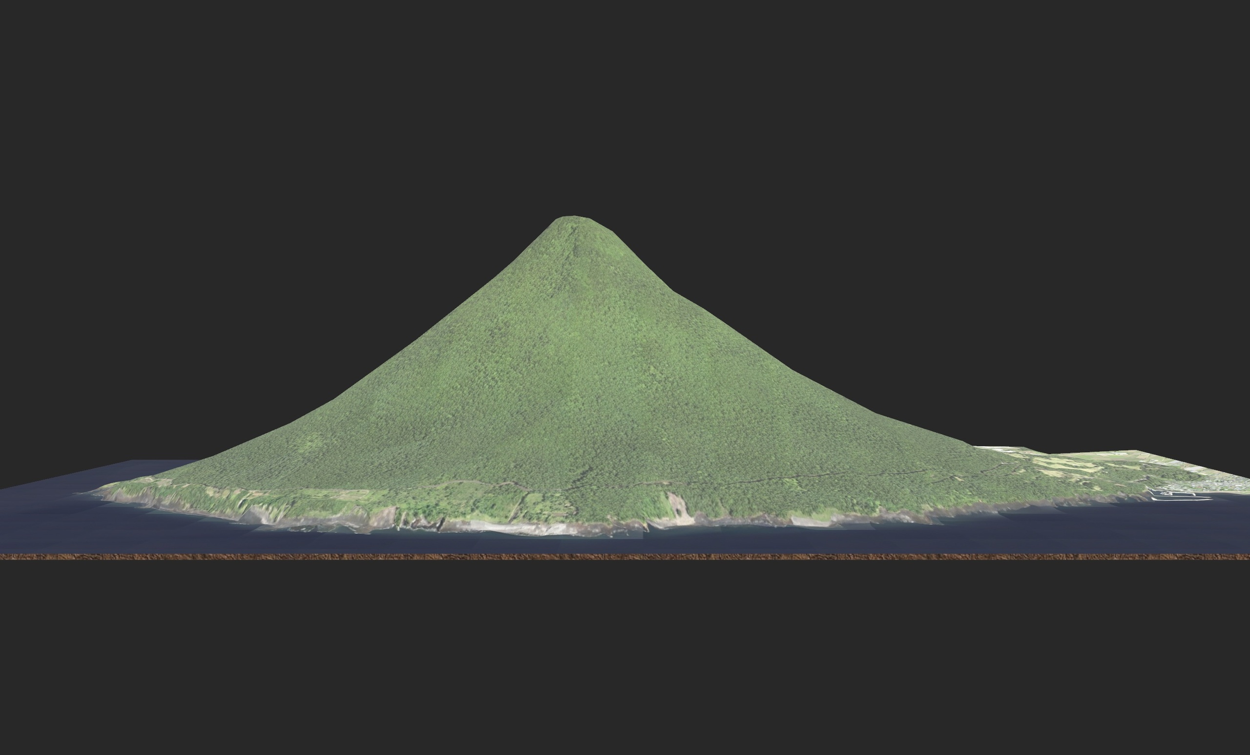
This 3D model accurately captures Kaimondake, a striking conical stratovolcano rising to 924 m above sea level at the southern tip of the Satsuma Peninsula in Kagoshima Prefecture, Japan. Ikidane Nippon+3Wikipedia+3en.my10.jp+3
Known for its perfectly symmetrical shape and sometimes called “Satsuma Fuji,” it stands out from the surrounding terrain and offers stunning views of the ocean, coastlines and inland lakes. Guide Very Japanese+1
Use this model for game environments, animated scenes, geographic visualizations, virtual tourism, or any project that calls for a realistic mountain landmark asset.
High-accuracy terrain based on real-world elevation: modelled from authentic data of Kaimondake’s volcanic shape and elevation. Wikipedia+1
Realistic material surfaces: 4K PBR texture maps simulate rock slopes, forest cover on lower slopes, and natural lighting/roughness of terrain.
Optimised mesh topology: efficient polygon count for real-time use in engines like Unity and Unreal, plus compatibility with Blender and other 3D tools.
Multiple export formats included: FBX, OBJ, GLB, STL for broad compatibility.
True-to-scale dimensions: the model preserves real proportions from base (near sea level) to summit (~924 m), enabling accurate integration into scenes.
Ready for integration: includes wireframe renders and usage notes to streamline import and setup.
Ideal Use Cases
Game developers creating mountain landscapes or Japan-based terrain levels
Animation/film works needing a striking volcanic mountain asset
Educators and researchers visualising Japanese geography or volcanic topography
VR/AR experiences that require an immersive mountain landmark
Kaimondake 3D model, Mount Kaimon 3D terrain, Satsuma Fuji 3D model, Kaimondake volcano Japan 3D, Kagoshima mountain 3D asset, Japanese conical volcano 3D, realistic mountain terrain model, PBR Japanese mountain model, 3D environment mountain Japan