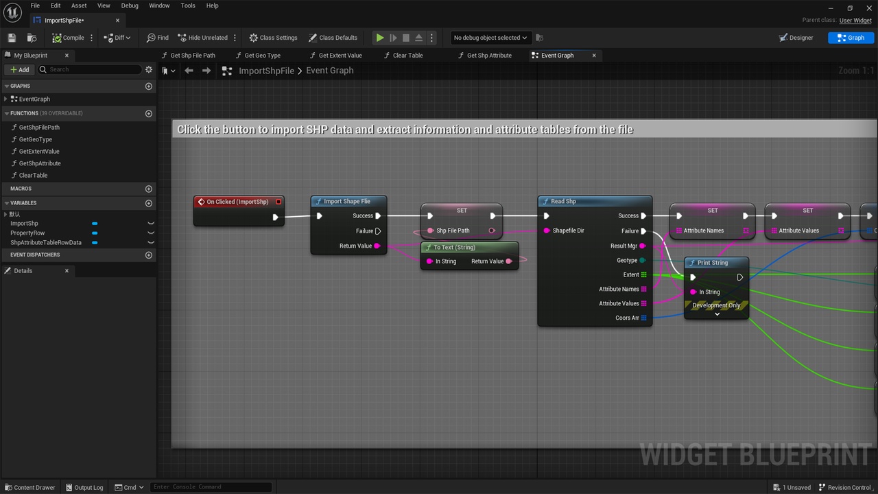


Description
Shp stands for Shapefile, a file format commonly used in Geographic Information Systems (GIS).Shapefile is a format for storing spatial vector data defined by Esri (Environmental Systems Research Institute), Inc. for storing, analyzing, and sharing geographic data in GIS software.
A Shapefile consists of multiple files, usually named with the same filename but different extensions. It contains three main files:
.shp file: contains information about spatial geometry, such as coordinate data for points, lines, or polygons.
.shx files: spatial index files for quick access to the geometry in the .shp files.
.dbf file: a table file containing attribute data for describing the attribute information associated with the geometry.
Documentation:https://1drv.ms/b/s!AmbE1VFBxhulkAlGgwNgBiODqXSA?e=0GfN3a